TRAN Committee Report
If you have any questions or comments regarding the accessibility of this publication, please contact us at accessible@parl.gc.ca.
|
APPENDIX A: MAPS
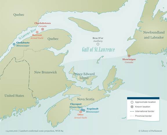
MAP 1: World War II Royal Canadian Navy Warship Losses – Eastern Canada
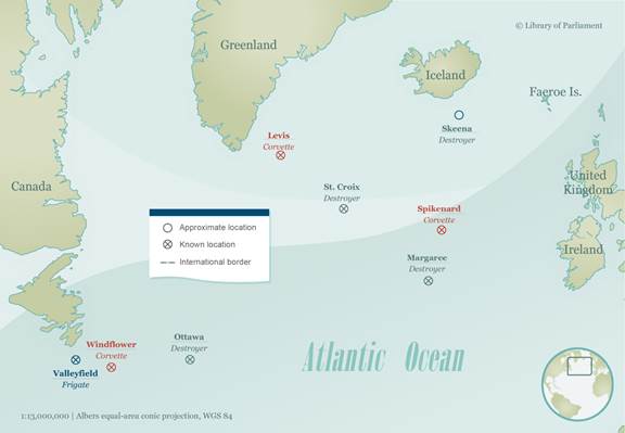
MAP 2: World War II Royal Canadian Navy Warship Losses – North Atlantic
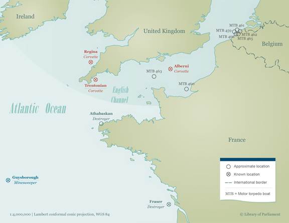
MAP 3: World War II Royal Canadian Navy Warship Losses – Europe
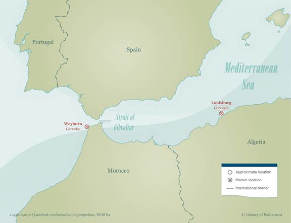
MAP 4: World War II Royal Canadian Navy Warship Losses – Mediterranean
Maps prepared by the Library of Parliament, Ottawa, 2018, using data from W.A.B. Douglas et al., “Appendix II, RCN Warship Losses, 1939-1945,” in A Blue Water Navy: The Official Operational History of the Royal Canadian Navy in the Second Word War, 1943-1945, Volume II, Part 2, Vanwell Publishing Limited, St. Catherines, Ontario, 2007, pp. 566-567; Natural Resources Canada (NRCan), “Boundary Polygons,” in Atlas of Canada National Scale Data 1:5,000,000 Series, NRCan, Ottawa, 2013; and Natural Earth, 1:10m, 1:50m and 1:110m Cultural Vectors, version 4.0.0. The following software was used: Esri, ArcGIS, version 10.4. Contains information licensed under Open Government Licence – Canada. |