
CIMM Committee Report

If you have any questions or comments regarding the accessibility of this publication, please contact us at accessible@parl.gc.ca.

PDF

Appendix A: Map of Roxham Road Area at the Canada–United States Border

Figure 1 — Map of Roxham Road Area at the Canada–United States Border

This map represents the area around Roxham Road and shows the Canada-United States border separating Quebec and the state of New York. On the American side, the city of Champlain is a little over three kilometers away from the official port of entry of Saint-Bernard-de-Lacolle in Quebec, Canada. Roxham Road runs north-south, with about a one km portion of the road on the American side of the border. It is approximately four kilometres west of Saint-Bernard-de-Lacolle. Within the map, there is a smaller inserted map further contextualizing the location of the area around Roxham Road. This smaller map shows a larger portion of the Canada-United States border in Quebec and the states of New York and Vermont. It also puts into perspective how close Montréal is from the Roxham Road area to the north, and how close Plattsburgh is to the south.

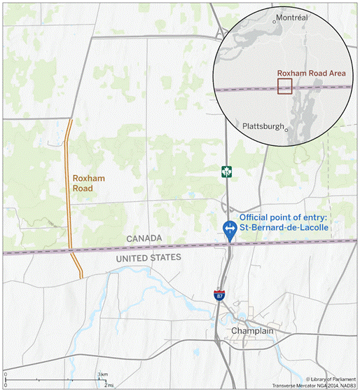
Source:  Map prepared by the Library of Parliament, Ottawa, 2022, using data from Canada Border Services Agency (CBSA), Directory of CBSA Offices and Services, accessed 9 November 2022. The World Topographic Canadian Style and Light Gray Canvas layers are the intellectual property of Esri and is used under licence, © 2022 Esri and its licensors. All rights reserved. The following software was used: Esri, ArcGIS Pro, version 3.0.2.